Beaver Brook Ravine
- Click here for Trails Map
- Click here for Pictures
- Click here for Forestry Management Plan
- Google Maps Coordinates: 40.658642,-74.872948
The Beaver Brook Ravine contains three hiking-only trails with White, Yellow and Green painted markers.
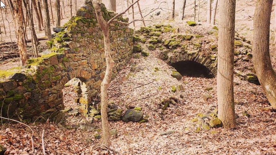
The White trail is a northern extension of the White trail in the Nassau system and extends to Herman Thau. It then follows an old road built to construct a CCC era water works project towards David Post Road. The stretch from Herman Thau Rd to the water works and nearby Amesbury Furnace mostly stays in sight of the brook and is an easy walk. The stretch from the furnace and waterworks to David Post Rd crosses several tributary streams and is a bit more challenging.
The Yellow trail mostly follows the path of an old wagon road used to haul iron ore from nearby mines, dating back to the 1750’s. The old road both begins and ends on private property, but the yellow trail markings begin and end along the White trail, crossing or joining the White trail along the way. Near the Amesbury Furnace, the Yellow trail can be taken downhill to that site, or can be followed northward along a raised bank left over from the CCC water works project, until it terminates at the White trail. This trail is a bit challenging in places.
The Green trail begins from the White trail, not far from David post Rd and descends toward Beaver Brook along an old footpath, at places marked with stone cairns. Crossing several tributary streams, it follows within sight of the brook until it terminates at the northern boundary of the property, where one must return by the same route. It is a scenic path, but the requires the most care in hiking, as there are several small streams to cross.